Under construction
This page is an active work in progress. The story map and Town Hall recording are still in development, publication lists are placeholders, and content and figures may change without notice. Please do not cite or circulate this page yet.
Mapping the Geography of ALS
A growing collection of ALS TDI tools, data, and reading on where people with ALS live, what they are exposed to, and how place shapes disease risk and outcomes. These resources are assembled to support researchers, clinicians, and the ALS community.
ALS TDI geospatial resources
-
ALS Geospatial Story Map
An interactive narrative walking through ALS geographic patterns and environmental context. Currently in development, with example slides shown below.
-
Town Hall Recording
A recording of the ALS TDI community town hall on geospatial research and ALS. We will link to the recording here once the event has taken place.
-
GeoALS
A nonprofit GIS platform that uses mapping to improve care, accelerate research, and advocate for the ALS community. ALS TDI partners with GeoALS on place-history research using ARC data.
-
ALS Geospatial Hub
Authoritative data from federal agencies, research institutions, and nonprofit organizations, organized by geography.
ALS Geospatial Story Map
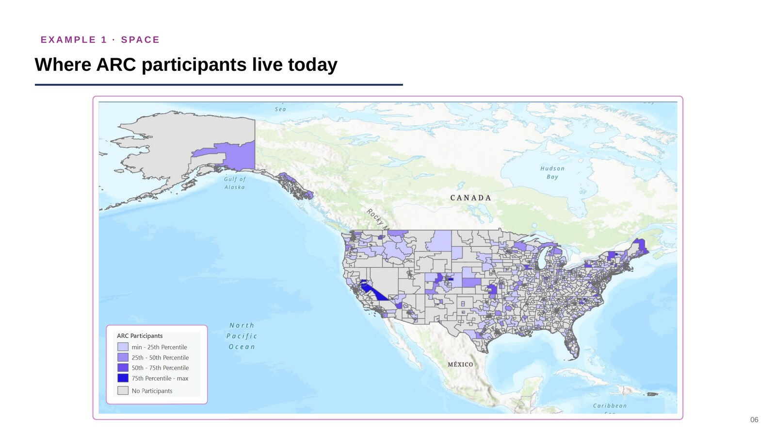
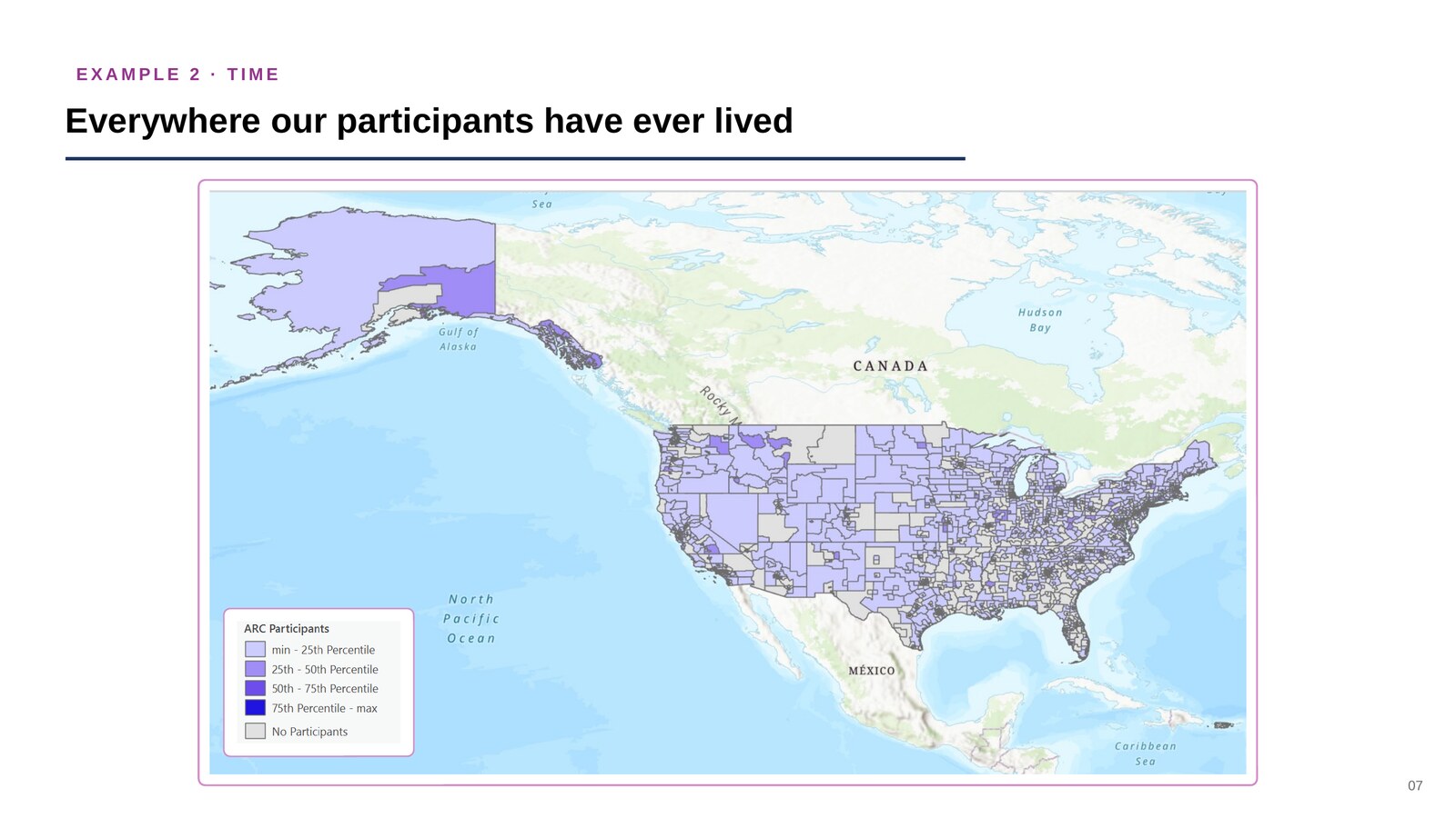
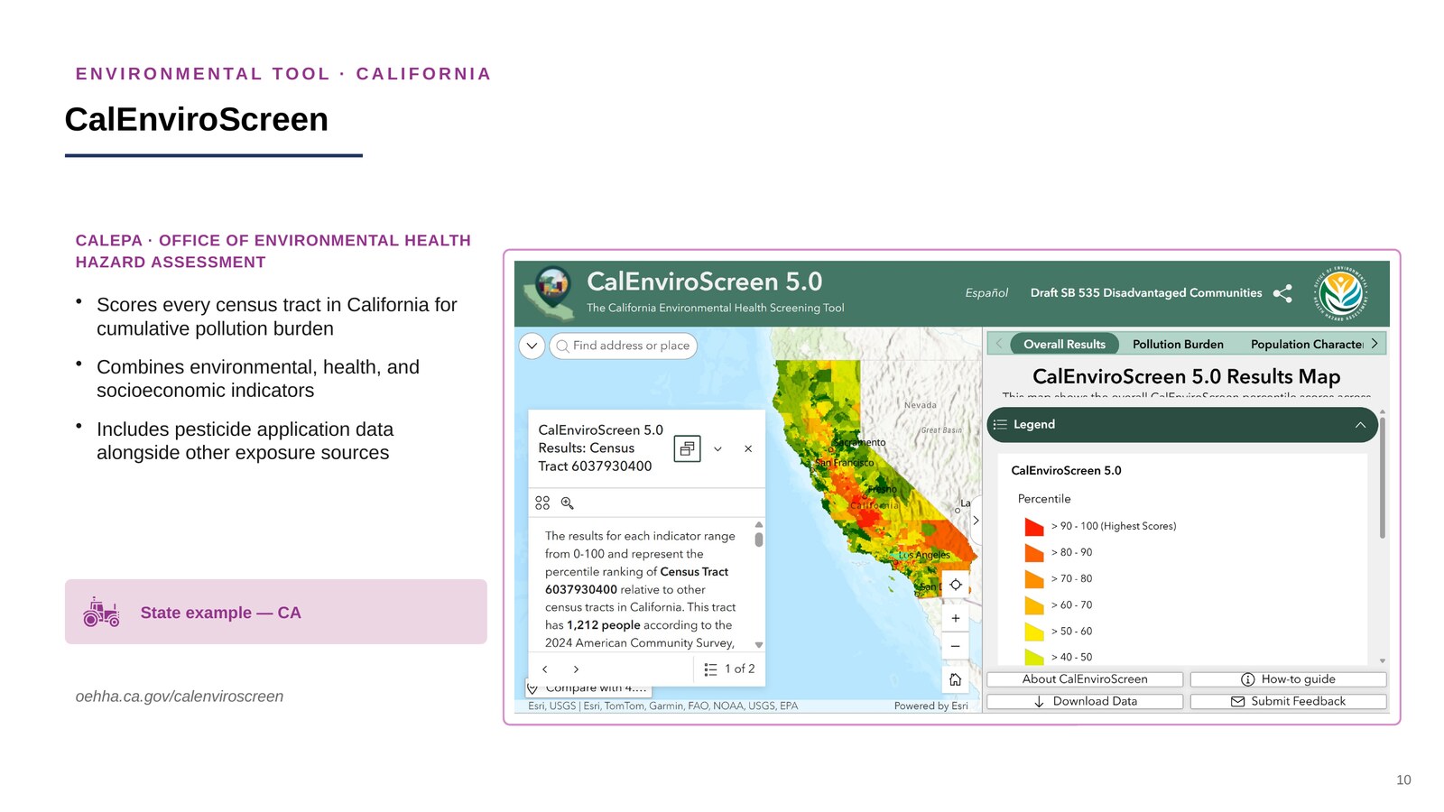
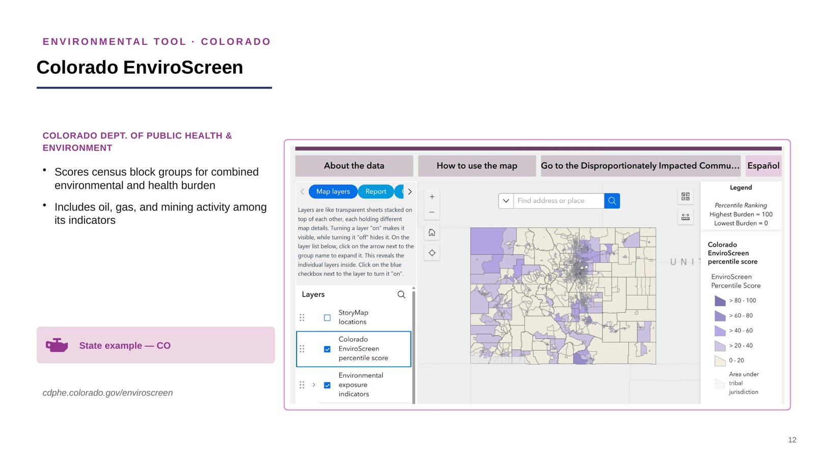
The interactive story map is still in development. In the meantime, the slides below are drawn from a draft ALS TDI deck, Mapping the ARC Study, and preview the kind of geographic narrative the story map will tell: how space, time, and environmental data come together to describe potential ALS risk factors.
Example slides, not final figures
These slides are draft examples included for illustration only. The maps, counts, and captions may change, and the live story map will replace this preview when it is ready. Please do not cite or circulate these figures.
Screenshot pending. A capture of the live GeoALS tool will appear here.
Town hall recording
ALS TDI hosts community town halls, and a session on geospatial research and ALS will be shared here once that event has taken place. Rather than embedding the recording, which may not be available to embed, this page links out to it directly.
ALS Town Hall | ALS Therapy Development Institute
Placeholder link
This points to the general ALS TDI Town Hall page. It will be replaced with a direct link to the geospatial research town hall recording once that event has taken place.
ARC cohort geography
Place-based context complements the ALS TDI risk factor work. These maps are produced through the GeoALS and ALS TDI collaboration, and are discussed in full on the ALS Risk Factors page.
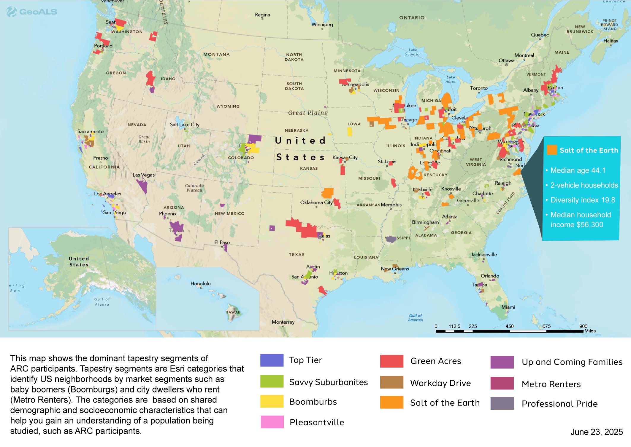
Neighborhood tapestry of ARC participants. Tapestry segments classify U.S. neighborhoods by shared demographic and socioeconomic profile, for example "Boomburbs" or "Metro Renters". Mapping the cohort this way characterizes who is enrolling.
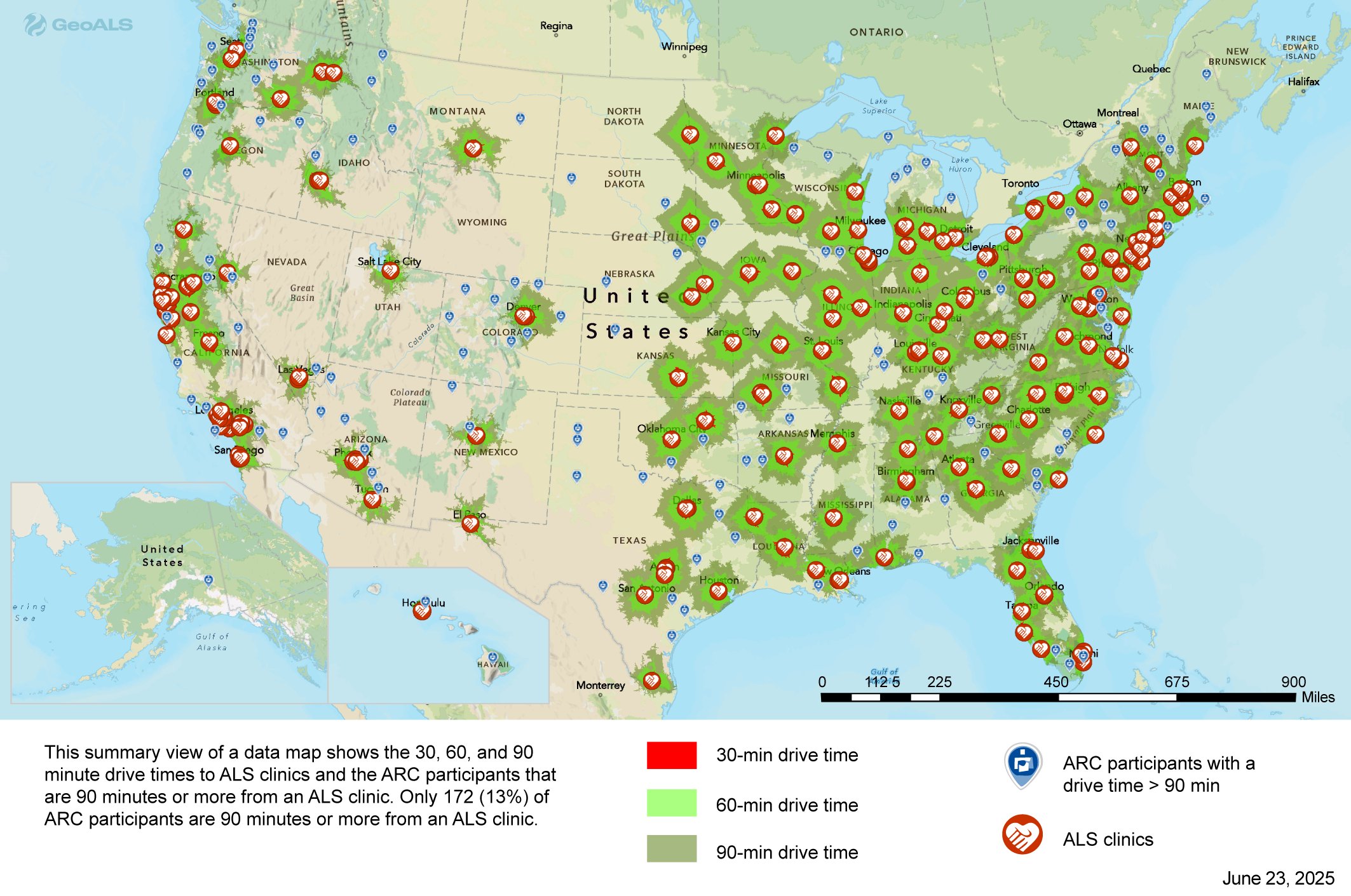
Drive time to ALS clinical care. Only about 13% of ARC participants live 90 minutes or more from an ALS clinic. Travel burden shapes who reaches specialty care, and so shapes ascertainment.
Publications and further reading
ALS TDI publications and education
- [Publication title] - Author(s), Journal, Year
- [Publication title] - Author(s), Journal, Year
See also the full Select Publications list.
Background reading
- [Article title] - Source, Year
Publicly available environmental health data
A field guide to publicly available environmental data: national screening tools and data platforms, plus each state's own environmental data or GIS portal. State entries point to each agency's data/GIS hub rather than to environmental justice screening tools specifically, since our users are often more interested in the underlying environmental quality data than in an aggregated screening index.
| Data hub or tool | Coverage |
|---|---|
| Loading list... | |
Collaborate with us
ALS TDI welcomes collaboration on geospatial and environmental health research in ALS. If you have a data set, a mapping capability, a research question, or a community partnership to propose, we would like to hear from you.
Get in touch with Hannah Walters, MPH, DrPH
Scientist, ALS Therapy Development Institute
The link opens an email with these prompts already filled in:
- Name, organization, and role
- What you would like to collaborate on
- Data, tools, or geographies involved
- Anything else we should know
Sources
Tool links were verified in August 2026 against the following:
- Besse, H. and Rojas-Rueda, D. (2025), Science of the Total Environment: https://doi.org/10.1016/j.scitotenv.2025.178449
- Individual agency pages for each tool, linked in the table above